

Maddie explains her research in Los Peñasquitos Lagoon to beach walk participants.
Our beach walk was a great success! We saw extreme beach erosion, infrastructure damage, and a recently excavated estuary mouth.
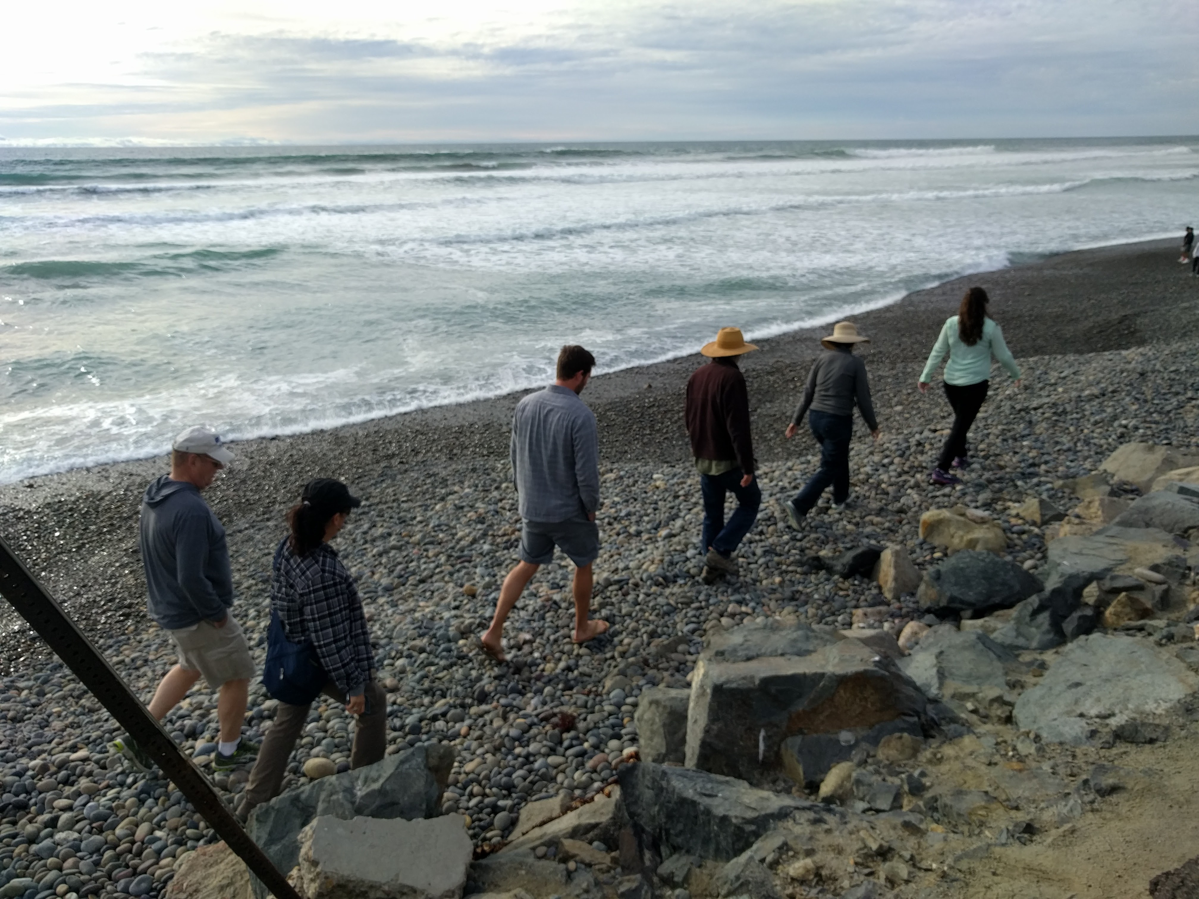
Participants walk along a very narrow beach with no more sand!
Astrid Hsu, MAS student at SIO Is studying the efficacy of beach walks and the Urban Tides Citizen Science Initiative, both to figure out who and why people join the Initiative and whether citizens are learning something from their participation. Click “read more” below to read preliminary findings of Astrids’ results! And if you want to participate check out the Urban Tides Initiative website (for those that want to use an app and/or on-line program) and the Storm Photo website ( for those who would rather send images via email). More information about El Niño and its effects see here.
Walking North: Lessons in Citizen Science – by Astrid Hsu, SIO MAS student
For those who didn’t join us last time, the Urban Tides Community Science Initiative unites coastal researchers and the public through photos. Any person can download the app on their phone or access the database through their computer and upload a photo of the coast whenever they are beachside. These photos give researchers like Dr. Sarah Giddings the ability to create and check models that provide insight to the effects of extreme tidal events, storms, sea level rise, and urban runoff. These events can lead to local flooding, sediment movement and erosion, and damage to infrastructure. Urban Tides beach walks are held to give people the chance to dive deeper into these issues and the opportunity to see these effects in person.
This time around, the beach walk was held at Torrey Pines State Reserve. In terms of seeing examples of coastal erosion, Torrey Pines is a gold mine. Crumbling bluffs to the north and south; morphing Los Peñasquitos Lagoon to the north; a deteriorating concrete parking lot to the west; and virtually no beach sand left, only cobbles!
At 3:30 on March 5th, we met at the reserve facility and USC Sea Grant’s Linda Chilton, who fought traffic to join us, gave a great overview of the app and initiative. With her were flood maps, useful depictions of where in San Diego that would flood in a 50-year and 100-year flood event. We then moved north, and along the way, we noticed large chunks of concrete were missing from the parking lot, as if something had taken bites out of it! Something did: the ocean, as a combination of high tidal energy, storms, waves, and warm water temperatures (contributing to sea level rise) carved out the soil underneath the concrete and weakened the integrity of the road.
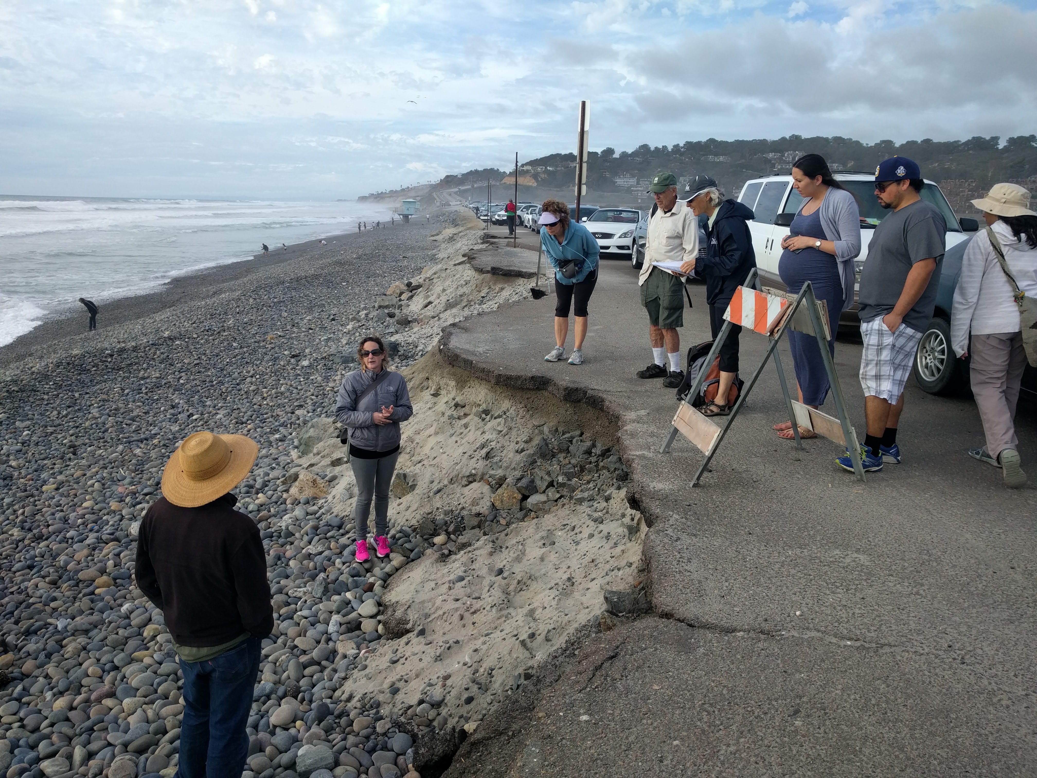
Using this example, Dr. Giddings explaining how high tide combined with storms can cause damage to infrastructure.
We were also lucky to have SIO PhD student Madeleine Harvey on board this walk who studies Los Peñasquitos Lagoon. This lagoon regularly changes its morphology, as sediment in the shallow waters can drastically move in a single day. Over the past couple weeks, the mouth of the lagoon became completely blocked by cobbles, cutting off the estuary from the ocean. The amount of sediment deposited was so much, a handrail that leads from the lot to the beach was practically buried! As such, State Parks intervened, bringing in bulldozers to clear the entryway. Unfortunately large waves closed the lagoon again only a day after our walk!
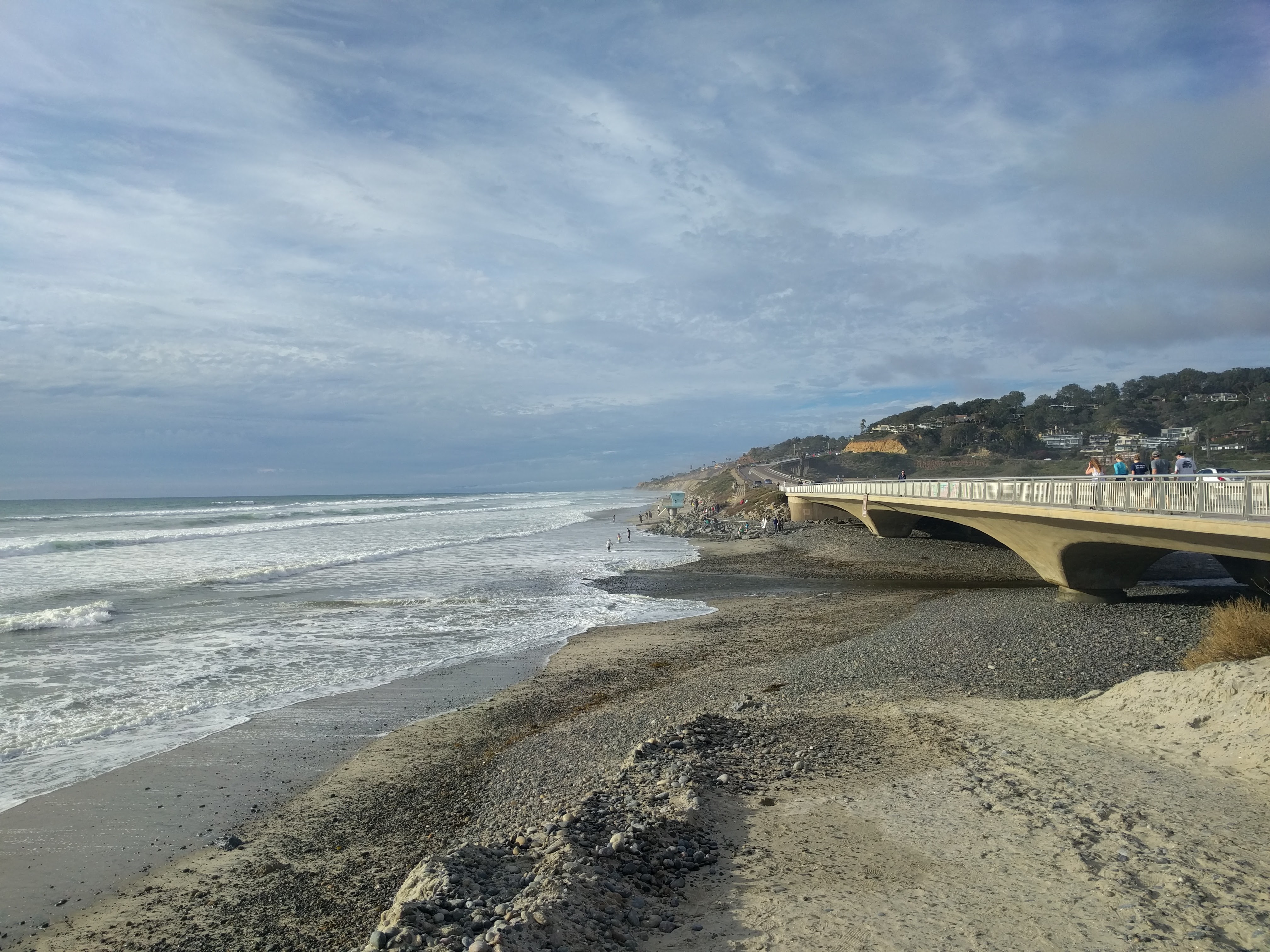
The temporarily cleared lagoon mouth!
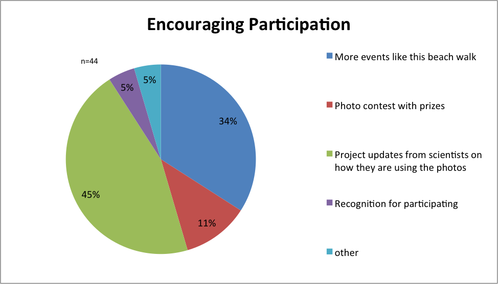
What would encourage more participation in the initiative?
Again, I asked the participants to complete a pre and post-survey to learn more about them and their motives for engaging in the initiative. Combined with the responses from the previous beach walk as well as responses collected from the online photo database, I’ve analyzed why people participate. It’s incredibly inspiring, as over 50% of participants attended to learn about local El Niño impacts and sea level rise, and 38% of participants wanted to learn information to share. It’s good to know that Urban Tides is fulfilling this educational role in the community, and that people are actually (statistically tested) walking away with new knowledge that can be shared.
It is truly remarkable to witness what the community can do: given the proper guidance and training, citizen scientists can unite into a formidable force that propels research and science. As an emerging field, it is key to learn from other existing programs, and the upcoming nationwide Citizen Science Day on April 16, 2016, is a perfect time to learn about this and other local opportunities. There is nothing more inspiring than seeing regular citizens transform into citizen scientists, and I’m incredibly grateful to witness it firsthand. Experience it for yourself, and join the initiative!